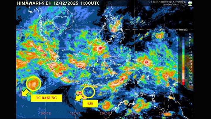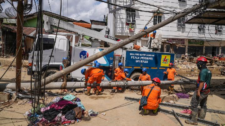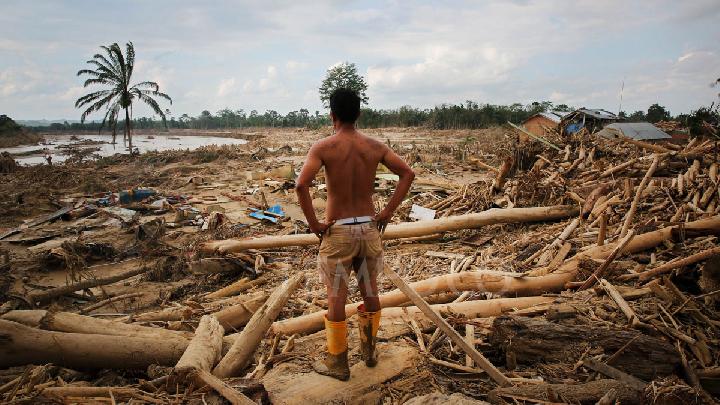
TEMPO.CO, Jakarta - Severe flooding hit the Province of Bali in September 2025. As of Thursday, September 11, 2025, the National Disaster Management Agency (BNPB) recorded 14 fatalities due to river overflows at at least 120 points on the Island of the Gods.
"The highest number of areas affected by the floods is in the City of Denpasar with 81 points," said the Head of Data, Information, and Communication Center for Disaster Management at BNPB, Abdul Muhari, in a written statement on Thursday, September 11, 2025.
Meanwhile, in the Gianyar Regency, there are 14 points, 12 points in the Badung Regency, 8 points in the Tabanan Regency, and 4 points each in the Karangasem and Jembrana Regencies. In the Klungkung Regency, floods occurred in the Dawan District.
Abdul mentioned that landslides occurred at 12 locations in Karangasem Regency, five locations in Gianyar Regency, and one location in Badung Regency. "Emergency handling is still ongoing by various parties in each region with the assistance of the Bali Provincial Disaster Management Agency and BNPB," he said.
This flood occurred after extreme rain hit several points in Bali following intense rain on Tuesday night, September 9, 2025. The flood is said to be the worst in Bali in several decades.
Environmental activists shed light on several issues contributing to the major floods. While extreme rainfall is a factor, they believe other causes have contributed to exacerbating the situation, including the conversion of massive green spaces and overtourism.
Massive Development in Bali
The Director of the Bali Environmental Forum, Made Krisna Dinata, also known as Bokis, mentioned that overtourism might be a major factor in this flood. "Considering one of the indicators of overtourism is the massive development," said Bokis in a brief message on Thursday, September 11, 2025.
According to him, massive development in Bali has reduced the open land that can absorb rainwater. The major flood that occurred, according to Bokis, is a sign that Bali is now more vulnerable to disasters.
To accommodate the increasing number of tourists, Bokis stated that agricultural land in Bali is gradually turning into buildings. "Environmental degradation, characterized by the conversion of land, especially agricultural land, into buildings," he said.
Bokis stated that rice fields are an important factor that has long protected Bali from floods. Because, he said, the rice fields in Bali have a traditional irrigation system called subak. The purpose of Subak is to distribute water so that it does not pool. With this system, one hectare of rice fields in Bali can hold up to 3,000 cubic tons of water.
If agricultural land and subak are increasingly converted into buildings, the natural hydrological system will be disrupted. "Water will not be contained and irrigated well, causing floods like the one we see today," said Bokis.
Bokis stated that development in Bali is not accompanied by good spatial planning. He says that the Bali Environmental Forum often discovers development plans that violate spatial planning regulations. "Such as the construction of tourism accommodations like hotels, villas, and others that convert rice fields and plantations into buildings," he said.
Furthermore, Bokis mentioned that development often exceeds coastal and river boundaries. "Even in disaster-prone areas," he said.
A research study also notes the massive conversion of land in Bali. In the research published in the Tunas Agraria Journal in September 2024, researchers Syahri Ramadhan and Ratna Patmawati Wisnu Murti noted the rapid conversion of rice fields in Bali. Particularly in the metropolitan areas of Denpasar, Badung, Gianyar, and Tabanan, or Sarbagita, which are the economic centers of the Bali Province.
The research found that 784.67 hectares of rice fields in Denpasar City were converted into buildings between 2018 and 2023. At the same time, 2,676.61 hectares of rice fields in the Tabanan Regency were converted into buildings. Meanwhile, in the Gianyar Regency, the conversion of rice fields reached 1,276.97 hectares, and in the Badung Regency, 1,099.67 hectares.
These figures do not include other open land that has also decreased in the Sarbagita metropolitan area. They include mixed gardens, forests, sandy beaches, open land, and bodies of water that have been used for residences and tourist accommodations.
Land Conversion and Climate Change
Yuyun Harmono, a climate and energy campaigner at Greenpeace Indonesia, said extreme rain is a major cause of flooding in Bali. However, high rainfall is not the only issue. "The high rainfall is exacerbated by a significant land conversion as well," said Yuyun on a phone call on Thursday, September 11, 2025.
Yuyun mentioned that land conversion in Bali is driven by the need to accommodate mass tourism. However, according to him, massive and unsustainable land conversion is not appropriate amidst the increasing climate crisis.
The climate crisis, said Yuyun, makes the weather less hospitable for humans and other living creatures. The heavy rainfall causing major floods in Bali indicates that climate change is increasingly affecting people's lives. "Climate change causes ocean warming, which then leads to more frequent extreme rainfall," said Yuyun.
Yuyun mentioned that climate change increases rainfall during the rainy season. Meanwhile, the climate crisis is causing increasingly deadly weather, such as recurring heat waves in European and Central Asian countries, in the summer.
According to Yuyun, the government needs to change the direction of development. Because people must immediately mitigate climate change. He said that strategies such as renewable energy and better spatial planning are crucial to preventing crises.
Editor's Choice: BNPB Identifies Over 120 Flooding Points in Bali
Click here to get the latest news updates from Tempo on Google News