February 11, 2026 | 04:32 pm
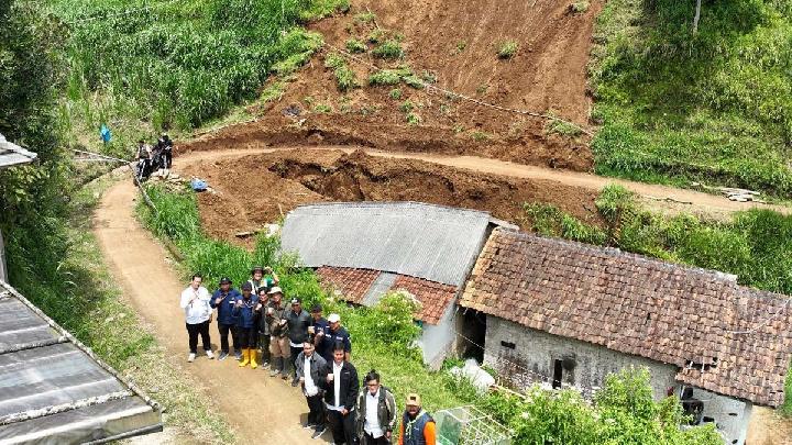
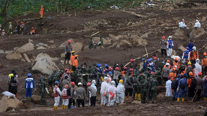
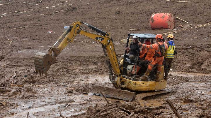
TEMPO.CO, Jakarta - A landslide in Lembang District, West Bandung Regency, reportedly claimed the lives of two residents in Sukadami Village. Additionally, two houses were affected, displacing 60 residents. A 60-meter village road is at risk of being severed.
According to the Geological Agency report, a landslide occurred in two locations in Sukajaya Village, Lembang District, West Bandung Regency. The first location was in Sukadami Village RT (neighborhood unit) 02 RW 07, while the second was in Cipariuk-Cihaseum Village RT 02 RW 12.
"Based on information from the residents, the ground movement occurred on Saturday, January 24, 2026, at 04:00 WIB (Western Indonesia Time), after being triggered by heavy rainfall in the preceding two days," said Acting Head of the Geological Agency Lana Saria in a written statement on Tuesday, February 10, 2026.
Lana, citing village officials, mentioned that three similar ground movements had occurred in the same area previously. Generally, the morphology of the landslide area consists of high undulating hillsides with steep to very steep slopes at angles of 32.1-43.4 degrees.
The steep valley morphology, according to Lana, forms highly potential critical slopes for ground movement. The valley's morphology is V-shaped with a straight profile that follows the narrow river flow.
The differing dimensions of the slope - 16 meters in length and 13.8 meters in height - indicate a significant height difference, causing the gravitational force on the slope material to increase. The landslide location is at an elevation of 1,346 meters above sea level (masl).
According to the landslide vulnerability zone map, the disaster site is classified as medium. Landslides can occur primarily in areas bordering river valleys, ravines, road cut slopes, and disturbed slopes. Additionally, old ground movements can be reactivated by high rainfall or vibrations.
Meanwhile, according to the forecast map for ground movements in January 2026 in the West Bandung Regency, Lembang District is categorized as having medium-to-high potential for ground movement, as well as for flash flooding and debris flows.
According to Lana, the ground movement in Sukadami Village and Cipariuk-Cihaseum Village is of the same type, translational. The movement occurs on the boundary of weathered ground and rock.
The causes of the landslide include weathered ground that allows water to pass through it, as well as loose and detached material above the volcanic rock layer. The contact between them forms the sliding surface of the ground movement. Another factor is the steep to very steep slope, which allows the ground to move easily and rapidly due to the significant gravitational effect.
Furthermore, the use of land for farming and vegetable greenhouses, such as pumpkins, tomatoes, legumes, and chili, which have roots that do not bind the soil, makes the slope critical. The water factor, namely a narrow drainage system, leads to uncontrolled water flow. "Extended periods of intense rainfall can trigger ground movements," Lana stated.
Ground movements at the disaster site still pose a potential risk and could worsen. Among other recommendations, the Geological Agency suggests relocating residents whose homes have been affected or damaged in at-risk areas.
It is also advised not to construct or develop buildings on the upper, middle, or lower parts of steep slopes, especially in the crown of a landslide, without structural mitigation in accordance with applicable guidelines. Furthermore, cutting tall and steep slopes that can disrupt slope stability without proper engineering slope reinforcement is prohibited.
Read: Three Tin Mining Bosses Declared Suspects in Incident That Killed 7 Miners
Click here to get the latest news updates from Tempo on Google News
98% of Mosques in Aceh Operational After 2025 Floods, Landslides
4 hari lalu
Most of the mosques or musallas have been re-utilized by the community despite being in an emergency condition.
Three Tin Mining Bosses Declared Suspects in Incident That Killed 7 Miners
4 hari lalu
The police in Bangka Belitung Islands have declared three individuals as suspects in a tin mining incident case.
Seven Illegal Tin Miners Buried Alive in Bangka Landslide
8 hari lalu
Seven illegal tin mine workers were buried alive after the wall of a mine at their location collapsed on Monday afternoon, February 2, 2026.
Landslide Kills Two Children in Bandung's Pangalengan
9 hari lalu

The West Java Regional Disaster Management Agency (BPBD) has reported a fatal landslide in Pangalengan District of Bandung Regency.
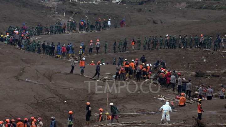
SAR Team Recovers 74 Victims of Cisarua Landslide
9 hari lalu
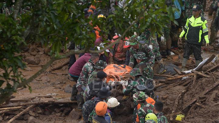
The joint search and rescue (SAR) team has recovered a total of 74 victims of the Cisarua landslide in West Bandung Regency, Indonesia.
Rescuers Continue Search for 20 Victims of West Bandung Landslide
11 hari lalu
Out of a total of 60 bodies found of the Cisarua landslide victims, 44 have been identified and returned to their families.
53 Bodies Were Evacuated from West Bandung Landslide
13 hari lalu
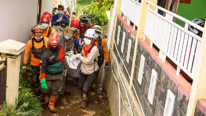
As of Tuesday, January 27, 2026, the number of identified victims of the Cisarua landslide has reached 37.
Bad Weather Halts Search for West Bandung Landslide Victims
13 hari lalu
The rain and strong winds caused the ground around the site to become unstable, risking subsequent landslides.
Indonesian Authorities Identify 20 Victims of West Bandung Landslide
15 hari lalu
A joint search and rescue team has delivered 38 body bags to the victim identification post following a landslide in Cisarua, West Java.
BNPB Says West Bandung Landslide Death Toll Reaches 17
16 hari lalu
The Indonesian National Disaster Management Agency (BNPB) reported that the death toll from the landslide in Cisarua, West Bandung Regency, reached 17