January 15, 2026 | 10:21 am
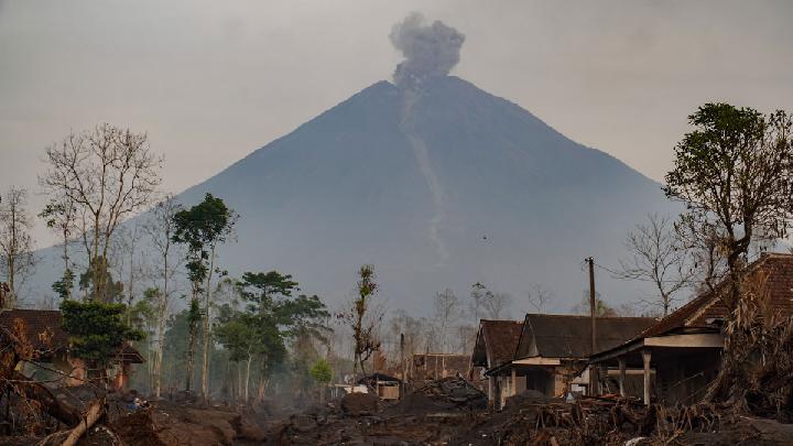
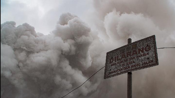
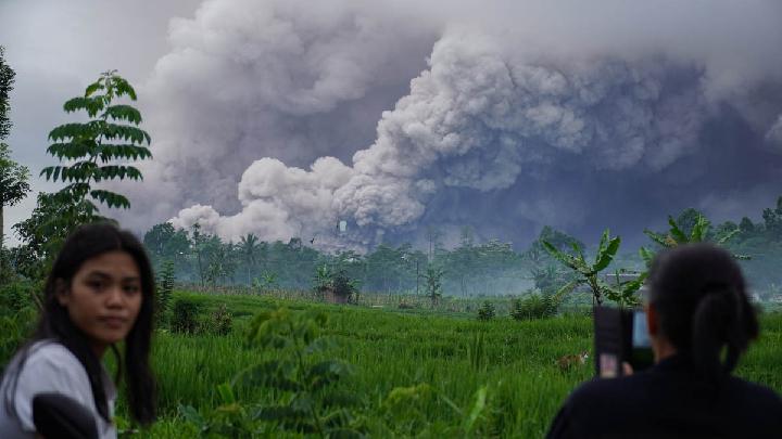
TEMPO.CO, Jakarta – Indonesia’s Geological Agency has reported that volcanic activity at Mount Semeru, the highest volcano on Java Island, remains elevated, with repeated pyroclastic flows recorded in recent days.
Acting Head of the Geological Agency Lana Saria said the heightened activity is marked by frequent pyroclastic flows, mainly directed toward the southeast sector. The flows have traveled up to 5 kilometers from the summit along the Besuk Kobokan drainage.
In a written report received by Tempo on Thursday morning, January 15, 2026, Lana said Mount Semeru remains at Level III (Alert) status through mid-January 2026.
Visual and instrumental monitoring on Wednesday recorded two pyroclastic flow events, each reaching approximately 5 kilometers from the summit toward the southeast.
She added that similar activity was observed repeatedly between January 7 and 14, 2026, accompanied by falling volcanic material. Seismic data during this period were dominated by eruption-related earthquakes, avalanches, explosive blasts, and harmonic tremors.
“The recorded seismic activity indicates a continued supply of material from beneath Mount Semeru, alongside the release of material to the surface through eruptions and explosive events,” Lana said.
According to Lana, measurements of seismic velocity variation (dv/v) showed large fluctuations. This suggests the volcanic system is currently in a relaxation phase rather than experiencing internal pressurization, but remains highly susceptible to renewed pressure buildup.
Deformation monitoring indicates a relatively stable pattern, suggesting there is no significant increase in pressure inside the volcano. Based on the latest analysis, Mount Semeru’s activity level remains at Level III (Alert).
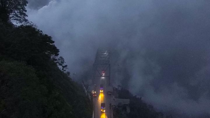
The Geological Agency has advised residents, visitors, and climbers to stay clear of a 5-kilometer radius around the Jonggring Seloko Crater. People are also warned not to enter the southeast sector extending up to 13 kilometers from the summit, which could reach as far as 17 kilometers along the Besuk Kobokan flow path.
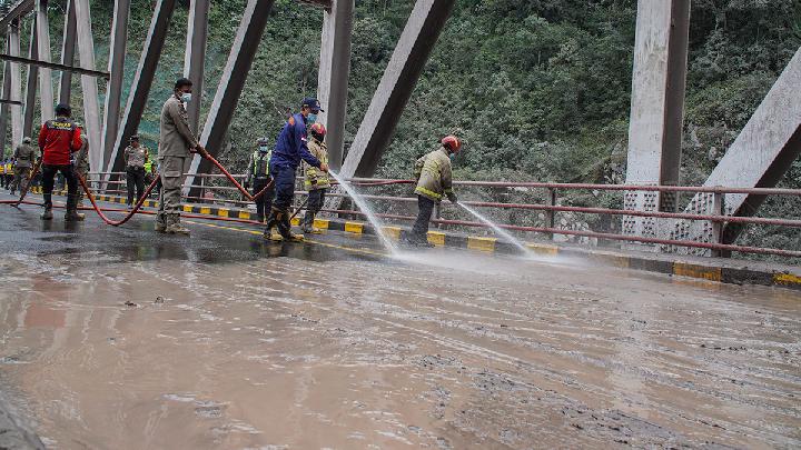
Communities are urged to remain vigilant for potential pyroclastic flows, lava collapses, and volcanic mudflows, or lahars, along rivers and valleys originating from the summit.
Areas of concern include Besuk Kobokan, Besuk Bang, Besuk Kembar, and Besuk Sat, as well as smaller tributaries connected to Besuk Kobokan.
Meanwhile, seismic observations from the Mount Semeru Observation Post in Lumajang recorded intense activity over the six-hour period from early Thursday until 06:00 AM local time.
During this interval, 36 eruption earthquakes were detected, with amplitudes ranging from 10 to 22 millimeters and durations of 53 to 133 seconds.
The monitoring post also recorded seven avalanche-related earthquakes, two explosive blast events, and one distant tectonic earthquake.
Read: Bandung Hit by Cold Temperatures of 19-20 Degrees Celsius
Click here to get the latest news updates from Tempo on Google News
Mount Semeru Spews Pyroclastic Flows and Lava Floods
14 jam lalu
Mount Semeru erupted on Wednesday with pyroclastic flows and seismic tremors. Authorities maintain a Level III Alert.
Fact Check: Viral Mount Semeru Eruption Video Was AI-Edited
1 hari lalu
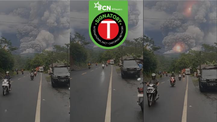
Fact check - The video circulating has been edited using AI from the original footage.
Mount Marapi Erupts in West Sumatra, Spewing Ash 1.2 Km High
30 hari lalu
Mount Marapi in West Sumatra experienced another eruption on Sunday evening, December 14, 2025.
BMKG Warns Prolonged Rain Could Trigger Mount Semeru Mudflows
40 hari lalu
BMKG has warned of possible mudflows and flash floods on Mount Semeru in East Java after morning rainfall on December 5, 2025.
How Dangerous Are Mount Semeru's Secondary Eruptions?
50 hari lalu
Smoke from Indonesia's Mount Semeru's secondary eruptions can be as dense as the primary pyroclastic flows
Understanding Indonesia's Four-Tier Volcanic Activity Levels
53 hari lalu
The Geological Agency has escalated Mount Semeru's activity status to Level IV. Here is Indonesia's classification of volcanic activity levels.
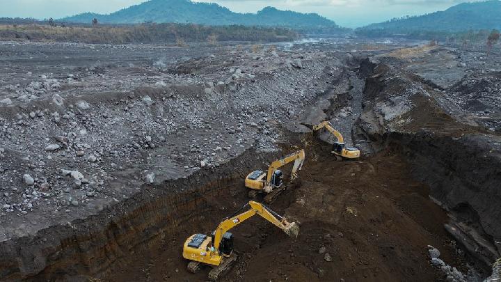
How Dangerous Are the Pyroclastic Flow Deposits in Mount Semeru's Valley?
54 hari lalu
Indonesia's Geological Agency head warned that Mount Semeru's recent pyroclastic deposits could cause secondary disasters if unmanaged.
187 Hikers Trapped by East Java's Mount Semeru Eruption Confirmed Safe
54 hari lalu
According to Indonesia's BNPB, 187 hikers were trapped along the popular Ranu Kumbolo trail when the Mount Semeru eruption occurred.
Key Facts on Mount Semeru Eruption: Casualties, Evacuations, and Aid Response
55 hari lalu
Mount Semeru in Lumajang, East Java, erupted on November 19, 2025.
No Airport Disruption Following Mount Semeru's Eruption, Says Airnav Indonesia
55 hari lalu

AirNav Indonesia stated that no airports were closed following the eruption of Mount Semeru. Flight route monitoring continues to operate.